Collaborative geographic data platform.
Access your 2D and 3D georeferenced projects under white-label branding.
Use cases.

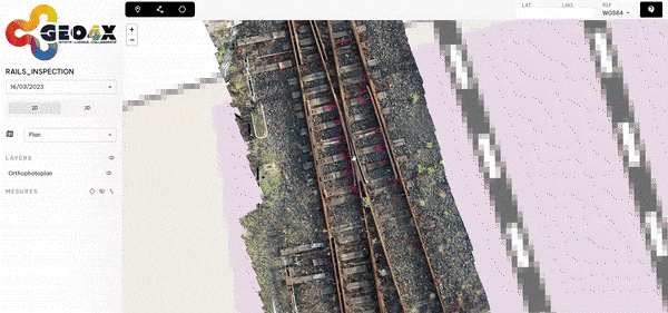
Rail inspection faster than trains.
Extremely precise localization of the various disorders thanks to fast, fluid visualization of a precise georeferenced orthomosaic with a resolution of less than 1 mm/pixel.

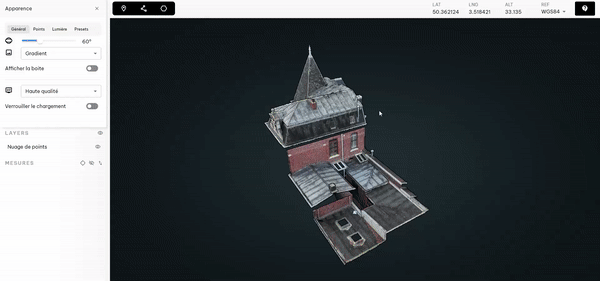
You'll know all the secrets of roofing.
Gain in human and material deployment.

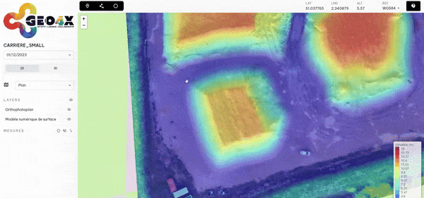
Cubature calculation in just a few clicks.
Thanks to measurement tools and an altimetric visualization of your surveys, quickly outline your stockpiles and calculate your volumes easily and efficiently.

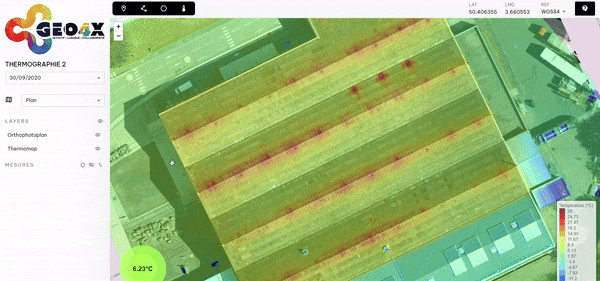
Thermomap in action.
Measuring temperatures on hot spots of an industrial building from a thermographic survey.

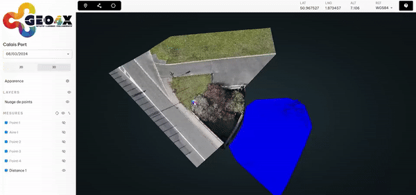
When water and air merge.
Cutting plan based on the fusion of 2 point clouds from a bathymetric survey and a drone survey.
Integrator of your geospatial data for your operational tasks.
Simplify the management of your building sites, land and infrastructures in a collaborative and intuitive way, through the viewer and the tools provided.
Visualize.

Measure.
Measurements, surface, volume (cubature), contour, cut/back, slope percentage, etc.


Export.
Save your measurements and export values in the desired format for your diagnosis and reports (.kml, .geojson, etc.).

Share.
Share any online data you like with anyone involved in the project (collaborators, partner, client).

Host.
Upload or download your data (kml, reports, documents) to complete and enrich the hosted solutions and support your decision-making processes.
You have control over your data.
100% French ecosystem
Full compliance with GDRP
Security of your data
Optimize and streamline your exchanges.

Customize the platform to suit your brand.
Offer a distinctive identity by customizing the platform according to your company's spirit and values. Add your logo and make your data your own.
Manage access rights.
Share data with your collaborators, clients, and partners based on their access level.

Different permissions.
- Visualize acquisitions
- Take measurements (marker, distance, area)
- Download data
- Measure volumes
- Saving measurements
- Add/delete users to project
- Define a public project
- Visualize acquisitions
- Take measurements (marker, distance, area)
- Download data
- Measure volumes
- Saving measurements
- Visualize acquisitions
- Take measurements (marker, distance, area)

Accessible anywhere, at any time. Spend less time in the field.

Communicate with your partners using a single tool.

Exchange ideas live, measure and organize your work on the platform.

Centralize project documents (specifications, prevention plan, etc.).
Our pricing plan.
Freemium
- 2GB of storage
- 1 permanent user
- 1 temporary user
- 1 administrator
- Data sharing with permissions
- Measurement tools
- Public link
Upload
- Orthomosaic
- Digital elevation model
- Point cloud
- Other files
*Removed after 100 days of inactivity.
Pro
Everything included in Freemium +:
- 100GB of storage
- 3 permanent users
- 10 temporary users
*No credit card required and 15-day trial
Enterprise
Everything included in Pro +:
- On-demand storage
- From 5 permanent users
- Temporary users on demand
- Platform customization
- Custom-built features
- Priority support with a dedicated account manager
- Payment by bank transfer
Upload
- Thermomap